This copy is copyright protected.
Copyright © 2025 Geographicus Rare Antique Maps
Digital Image: 1947 Salmon City Plan or Map of Jerusalem
JerusalemOldCity-salmon-1947_d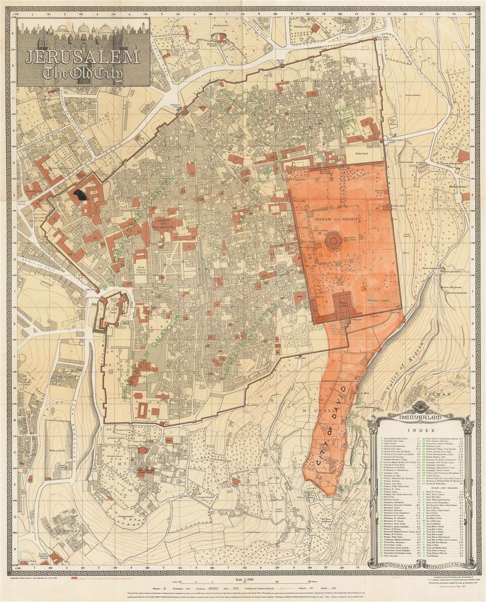

FOR THE ORIGINAL ANTIQUE MAP, WITH HISTORICAL ANALYSIS, CLICK HERE.
Digital Map Information
Geographicus maintains an archive of high-resolution rare map scans. We scan our maps at 300 DPI or higher, with newer images being 600 DPI, (either TIFF or JPEG, depending on when the scan was done) which is most cases in suitable for enlargement and printing.
Delivery
Once you purchase our digital scan service, you will receive a download link via email - usually within seconds. Digital orders are delivered as ZIP files, an industry standard file compression protocol that any computer should be able to unpack. Some of our files are very large, and can take some time to download. Most files are saved into your computer's 'Downloads' folder. All delivery is electronic. No physical product is shipped.
Credit and Scope of Use
You can use your digial image any way you want! Our digital images are unrestricted by copyright and can be used, modified, and published freely. The textual description that accompanies the original antique map is not included in the sale of digital images and remains protected by copyright. That said, we put significant care and effort into scanning and editing these maps, and we’d appreciate a credit when possible. Should you wish to credit us, please use the following credit line:
Courtesy of Geographicus Rare Antique Maps (http://www.geographicus.com).
How Large Can I Print?
In general, at 300 DPI, you should at least be able to double the size of the actual image, more so with our 600 DPI images. So, if the original was 10 x 12 inches, you can print at 20 x 24 inches, without quality loss. If your display requirements can accommodate some loss in image quality, you can make it even larger. That being said, no quality of scan will allow you to blow up at 10 x 12 inch map to wall size without significant quality loss. For more information, it is best consult a printer or reprographics specialist.
Refunds
If the high resolution image you ordered is unavailable, we will fully refund your purchase. Otherwise, digital images scans are a service, not a tangible product, and cannot be returned or refunded once the download link is used.
Frederick John Salmon (1882 - July 8, 1964) was a British surveyor, foreign service officer, and soldier. He served in the Ceylon Survey from 1908 through 1930, with the exception of serving on the Western Front during World War I. During the war, he made a name for himself by promoting cooperation between surveying and artillery. He was also particularly enthusiastic about printing and distributing updated maps and using aerial photography to update tactical maps. He became a Fellow of the Royal Geographical Society in December 1918. Between 1930 and 1933, Salmon directed the Lands and Survey Departments in Cyprus, but was named Director of the Palestine Survey at the end of 1932. He began work at the Survey of Palestine on March 27, 1933, and began an initiative to begin a modern topographical mapping of Palestine. He was appointed Commissioner for Lands and Surveys of Palestine and as a member of the Advisory Council to the Government of Palestine in 1935. After a thirty-year career surveying sites around the Empire, Salmon retired on July 13, 1938. His cartographic work is part of the collection at the Royal Geographical Society. More by this mapmaker...
Copyright © 2025 Geographicus Rare Antique Maps | Geographicus Rare Antique Maps
This copy is copyright protected.
Copyright © 2025 Geographicus Rare Antique Maps