This copy is copyright protected.
Copyright © 2025 Geographicus Rare Antique Maps
Digital Image: 1887 U.S. Geological Survey Pocket Map western Nantucket, Massachusetts
Muskeget-usgs-1887_d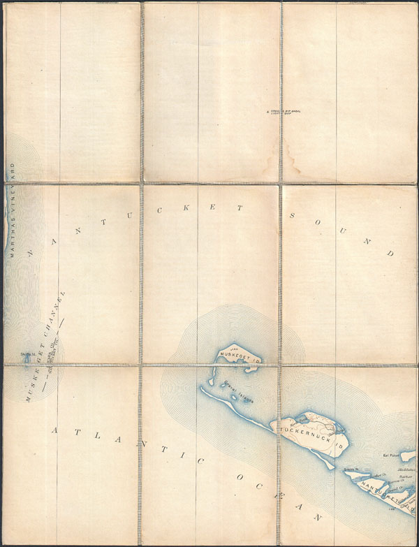

FOR THE ORIGINAL ANTIQUE MAP, WITH HISTORICAL ANALYSIS, CLICK HERE.
Digital Map Information
Geographicus maintains an archive of high-resolution rare map scans. We scan our maps at 300 DPI or higher, with newer images being 600 DPI, (either TIFF or JPEG, depending on when the scan was done) which is most cases in suitable for enlargement and printing.
Delivery
Once you purchase our digital scan service, you will receive a download link via email - usually within seconds. Digital orders are delivered as ZIP files, an industry standard file compression protocol that any computer should be able to unpack. Some of our files are very large, and can take some time to download. Most files are saved into your computer's 'Downloads' folder. All delivery is electronic. No physical product is shipped.
Credit and Scope of Use
You can use your digial image any way you want! Our digital images are unrestricted by copyright and can be used, modified, and published freely. The textual description that accompanies the original antique map is not included in the sale of digital images and remains protected by copyright. That said, we put significant care and effort into scanning and editing these maps, and we’d appreciate a credit when possible. Should you wish to credit us, please use the following credit line:
Courtesy of Geographicus Rare Antique Maps (http://www.geographicus.com).
How Large Can I Print?
In general, at 300 DPI, you should at least be able to double the size of the actual image, more so with our 600 DPI images. So, if the original was 10 x 12 inches, you can print at 20 x 24 inches, without quality loss. If your display requirements can accommodate some loss in image quality, you can make it even larger. That being said, no quality of scan will allow you to blow up at 10 x 12 inch map to wall size without significant quality loss. For more information, it is best consult a printer or reprographics specialist.
Refunds
If the high resolution image you ordered is unavailable, we will fully refund your purchase. Otherwise, digital images scans are a service, not a tangible product, and cannot be returned or refunded once the download link is used.
The Office of the Coast Survey (later the U.S. Geodetic Survey) (1807 - present), founded in 1807 by President Thomas Jefferson and Secretary of Commerce Albert Gallatin, is the oldest scientific organization in the U.S. Federal Government. Jefferson created the "Survey of the Coast," as it was then called, in response to a need for accurate navigational charts of the new nation's coasts and harbors. The first superintendent of the Coast Survey was Swiss immigrant and West Point mathematics professor Ferdinand Hassler. Under the direction of Hassler, from 1816 to 1843, the ideological and scientific foundations for the Coast Survey were established. Hassler, and the Coast Survey under him developed a reputation for uncompromising dedication to the principles of accuracy and excellence. Hassler lead the Coast Survey until his death in 1843, at which time Alexander Dallas Bache, a great-grandson of Benjamin Franklin, took the helm. Under the leadership A. D. Bache, the Coast Survey did most of its most important work. During his Superintendence, from 1843 to 1865, Bache was steadfast advocate of American science and navigation and in fact founded the American Academy of Sciences. Bache was succeeded by Benjamin Pierce who ran the Survey from 1867 to 1874. Pierce was in turn succeeded by Carlile Pollock Patterson who was Superintendent from 1874 to 1881. In 1878, under Patterson's superintendence, the U.S. Coast Survey was reorganized as the U.S. Coast and Geodetic Survey (C & GS or USGS) to accommodate topographic as well as nautical surveys. Today the Coast Survey is part of the National Oceanic and Atmospheric Administration or NOAA. More by this mapmaker...
The Old Corner Book Store (1828 - 1950) of 27-29 Bromfield Street is one of Boston's oldest and most historic locations. The structure that the Book Store occupied, still called the Old Corner Book Store, was originally built in 1712 as an apothecary shop. In 1828 Carter & Hendee took over the space and reinvented it as a bookshop. Later it fell into the hands of publishers Ticknor and James Fields. On November 12, 1864, shortly after Ticknor died, Fields sold the Old Corner Bookstore to E. P. Dutton. Dutton ran the business until his own retirement in 1869, when Alexander Williams took over the space, running it as A. Williams Publishers, Booksellers and Importers until his own retirement in 1883. In the 1890s it served as a magazine store. Such important literary giants as Henry Wadsworth Longfellow, James Russell Lowell, Henry David Thoreau, Ralph Waldo Emerson, Nathaniel Hawthorne, and Harriet Beecher Stowe were known to frequent the establishment. Due to its many literary connections, this shop published some of the most important American books ever written, including The Scarlet Letter, Walden, and the Atlantic Monthly Magazine. The space remained open as a bookstore for nearly 100 years before closing c. 1950. For a time it was converted to a parking garage until acquired by Historic Boston, Inc., who preserved it. Today the Globe Bookstore, in Harvard Square is considered its successor. The Old Corner Book Store building has been fully restored as a historic monument and is currently occupied by a jewelry store. Learn More...
Copyright © 2025 Geographicus Rare Antique Maps | Geographicus Rare Antique Maps
This copy is copyright protected.
Copyright © 2025 Geographicus Rare Antique Maps