This copy is copyright protected.
Copyright © 2025 Geographicus Rare Antique Maps
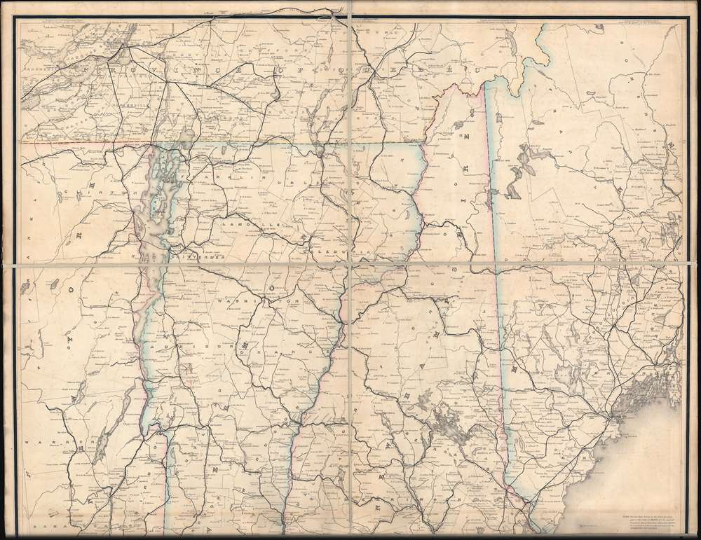
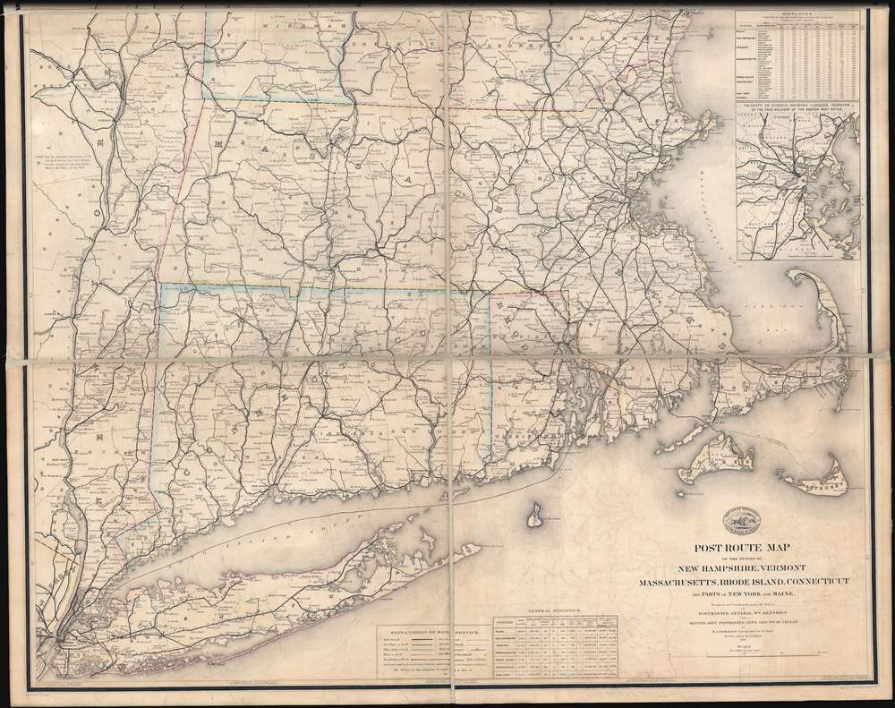
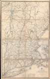
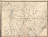
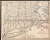
Digital Image: 1878 Post Office Dept. Map Wall Map of New England w/ Gold mines?
NewEngland-postoffice-1878_d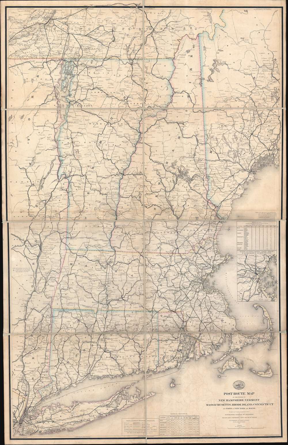

FOR THE ORIGINAL ANTIQUE MAP, WITH HISTORICAL ANALYSIS, CLICK HERE.
Digital Map Information
Geographicus maintains an archive of high-resolution rare map scans. We scan our maps at 300 DPI or higher, with newer images being 600 DPI, (either TIFF or JPEG, depending on when the scan was done) which is most cases in suitable for enlargement and printing.
Delivery
Once you purchase our digital scan service, you will receive a download link via email - usually within seconds. Digital orders are delivered as ZIP files, an industry standard file compression protocol that any computer should be able to unpack. Some of our files are very large, and can take some time to download. Most files are saved into your computer's 'Downloads' folder. All delivery is electronic. No physical product is shipped.
Credit and Scope of Use
You can use your digial image any way you want! Our digital images are unrestricted by copyright and can be used, modified, and published freely. The textual description that accompanies the original antique map is not included in the sale of digital images and remains protected by copyright. That said, we put significant care and effort into scanning and editing these maps, and we’d appreciate a credit when possible. Should you wish to credit us, please use the following credit line:
Courtesy of Geographicus Rare Antique Maps (http://www.geographicus.com).
How Large Can I Print?
In general, at 300 DPI, you should at least be able to double the size of the actual image, more so with our 600 DPI images. So, if the original was 10 x 12 inches, you can print at 20 x 24 inches, without quality loss. If your display requirements can accommodate some loss in image quality, you can make it even larger. That being said, no quality of scan will allow you to blow up at 10 x 12 inch map to wall size without significant quality loss. For more information, it is best consult a printer or reprographics specialist.
Refunds
If the high resolution image you ordered is unavailable, we will fully refund your purchase. Otherwise, digital images scans are a service, not a tangible product, and cannot be returned or refunded once the download link is used.
Walter Lamb Nicholson (April 27, 1825 - April 13, 1895) was a topographer working with the United States Postal Service in the second half of the 19th century. Nicholson was born in Edinburgh, Scotland, where he trained as a civil engineer. He emigrated to the United States in 1856, registered for the draft in the American Civil War (1861 - 1865) in 1863, and naturalized as U.S. Citizen in 1873. By 1860 he was working in Washington D.C. as a lithographer with the U.S. Coast Survey, where he introduced photolithographic technology. On July 15, 1861, he transitioned to the Postal Department, where he succeeded Henry A. Burr (1809 - 1863) as official 'Topographer'. He issued numerous important postal route maps from about 1866 to his retirement in 1887. His postal maps continued to be used and updated by subsequent Postal Topographers until about 1900. More by this mapmaker...
Paul Goepel (February 24, 1744 - June 17, 1913) was a clerk and draughtsman active with the Topographic Office of the United States Postal Service in Washington D.C. during the mid to late 19th century. Goepel was born in Stuttgart, Württemberg, Germany. He emigrated to the United States in August of 1863, settling in Washington D.C. Goepel was naturalized as a U.S. Citizen in 1868, while he was a student at Columbian College of Arts and Sciences (George Washington University). Shortly there after he began working with the United States Postal Service. He appears in city directories and Post Office records as a Clerk to about 1870, after which he is registered as a Topographical Draughtsman. Upon retirement he relocated to Hoboken, New Jersey and later New York City. His son, Carl Paul Goepel (1879 - 19??), was a Patent Counsel in the Washington D.C. Patent Office. Learn More...
David McClelland (1820 - 1899) was a Washington D.C. based copper plate engraver and publisher active from at least 1840 to about 1876. His work mainly consists of maps and other engraved documents for government publications, including maps for the Army Bureau of Topographical Engineers, Senate Reports, and General Land Office. In 1840, when he was just 19, McClelland was partnered with William Smith under the imprint of 'Smith and McClelland' with offices on Pennsylvania Avenue between 2nd and 3rd. The ordering of names in the imprint suggests that Smith was the senior partner, possibly the person who trained McClelland in engraving. While there is little evidence of Smith, there was an engraver of this name in Washington D.C. doing government engraving in the 1850s, and another living in Philadelphia. It is unclear if they are the same or different individuals. The partnership eventually dissolved, at which point Smith moved to Pennsylvania Avenue near 11h Street and McClellend to the Old Medical Collage at 10th and East Streets. McClelland is best known for his engraving of the important 1861 Albert Boschke map of Washington D.C. and the 1846 Topographical Engineers map of Florida. In 1863, during the American Civil War, McClelland had an altercation with the Federal Government War Department over the plates for the Boschke Map, which he owed in partnership with several others. The plates were ultimately seized without compensation for war use. After the war, McClelland appealed to Congress for restitution, which was finally granted in the 1890s. In the 1860s, McClelland published under the imprint of 'D. McClelland, Blanchard and Mohun' and 'D. McClelland, Blanchard and Mohun, Hugh b. Sweeny and Thomas Blagdon.' McClelland lived in Le Droit Park and is possibly responsible for that neighborhood being named as such. Learn More...
Copyright © 2025 Geographicus Rare Antique Maps | Geographicus Rare Antique Maps
This copy is copyright protected.
Copyright © 2025 Geographicus Rare Antique Maps