This copy is copyright protected.
Copyright © 2025 Geographicus Rare Antique Maps
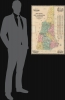
Digital Image: 1854 Dodge Map of New Hampshire (First Edition)
NewHampshire-dodge-1854-2_d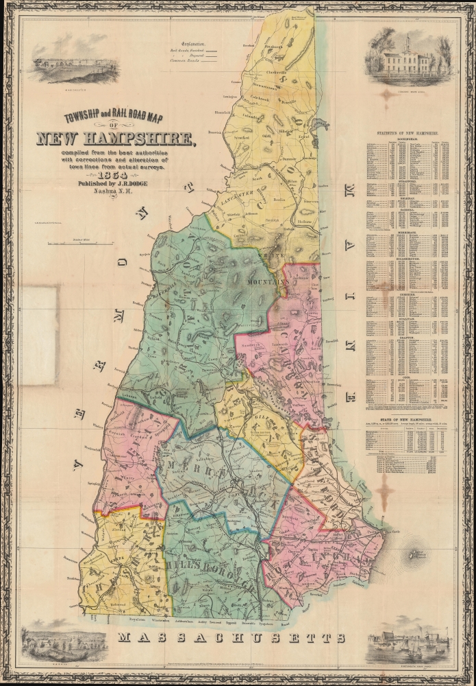

FOR THE ORIGINAL ANTIQUE MAP, WITH HISTORICAL ANALYSIS, CLICK HERE.
Digital Map Information
Geographicus maintains an archive of high-resolution rare map scans. We scan our maps at 300 DPI or higher, with newer images being 600 DPI, (either TIFF or JPEG, depending on when the scan was done) which is most cases in suitable for enlargement and printing.
Delivery
Once you purchase our digital scan service, you will receive a download link via email - usually within seconds. Digital orders are delivered as ZIP files, an industry standard file compression protocol that any computer should be able to unpack. Some of our files are very large, and can take some time to download. Most files are saved into your computer's 'Downloads' folder. All delivery is electronic. No physical product is shipped.
Credit and Scope of Use
You can use your digial image any way you want! Our digital images are unrestricted by copyright and can be used, modified, and published freely. The textual description that accompanies the original antique map is not included in the sale of digital images and remains protected by copyright. That said, we put significant care and effort into scanning and editing these maps, and we’d appreciate a credit when possible. Should you wish to credit us, please use the following credit line:
Courtesy of Geographicus Rare Antique Maps (http://www.geographicus.com).
How Large Can I Print?
In general, at 300 DPI, you should at least be able to double the size of the actual image, more so with our 600 DPI images. So, if the original was 10 x 12 inches, you can print at 20 x 24 inches, without quality loss. If your display requirements can accommodate some loss in image quality, you can make it even larger. That being said, no quality of scan will allow you to blow up at 10 x 12 inch map to wall size without significant quality loss. For more information, it is best consult a printer or reprographics specialist.
Refunds
If the high resolution image you ordered is unavailable, we will fully refund your purchase. Otherwise, digital images scans are a service, not a tangible product, and cannot be returned or refunded once the download link is used.
Jacob Richard Dodge (September 28, 1923 - c. 1890) was an American publisher, poet, and journalist. Born in New Boston, New Hampshire, Dodge learned the art of printing in the offices of the Amherst Cabinet, a local newspaper. After graduating from school he accepted a post as a schoolmaster in Mississippi, where he remained for five years, before returning to Nashua, New Hampshire. During this period in Nashua he published his only map, a railroad guide and wall map of New Hampshire. In 1855 he moved to Ohio, where he published the American Ruralist, a regional agricultural newspaper. In 1861 Dodge again relocated, this time to Washington D. C. There he took a position as Senate Reporter for the National Intelligencer. From 1866 to 1878 he worked as Statistician for the Department of Agriculture. In this role he was sent to Europe to represent United States agriculture at the 1873 Vienna Exhibition. Dodge continued to work in statistics with the U.S. Government until the 1880s. It is unclear when Dodge died.3 More by this mapmaker...
Lodowick Harrington Bradford (November 10, 1820 - December 13, 1885) was a Boston based engraver lithographer active in the second half of the 19th century. Bradford was born in Boston, Massachusetts. He studied as a line engraver before transitioning to the then new art of lithography. He even invented his own photolithographic ambrotype process that created a durable photographic picture on lithographic stone. In 1849 he partnered with Ebenezer Tappen (1815 - 1854) to form the Boston firm of Tappan and Bradford. The partnership remained active until Tappan's untimely death in January, 1854. From 1854 to 1859 Bradford continued to operate the firm, but the imprint changed to 'L. H. Bradford and Company.' It is not clear who the 'and Company' was, possibly Tappan's heirs? From late 1859 until his 1870, he printed under 'L. H. Bradford.' His last known lithographs appeared in 1860, but he did continue copper and steel engraving until his death. Bradford was married to Martha Brown, from an old Gloucester Family. After his wedding in 1849, he divided his time between Gloucester and Boston. In Gloucester he made the acquaintance of the local painter Fitz Henry Lane (1804 - 1865) and worked with him to produce several views in the 1850s. He died on the road between Boston and Gloucester in 1885. Learn More...
Copyright © 2025 Geographicus Rare Antique Maps | Geographicus Rare Antique Maps
This copy is copyright protected.
Copyright © 2025 Geographicus Rare Antique Maps