This copy is copyright protected.
Copyright © 2025 Geographicus Rare Antique Maps
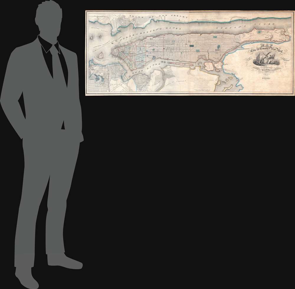
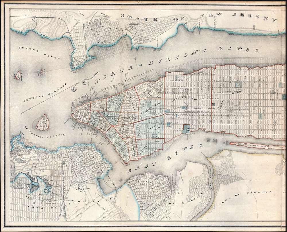
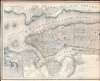
Digital Image: 1840 Burr Map of Manhattan, New York City
NewYork-burr-1840_d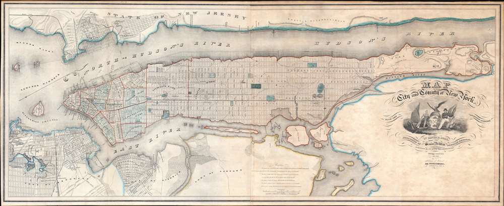

FOR THE ORIGINAL ANTIQUE MAP, WITH HISTORICAL ANALYSIS, CLICK HERE.
Digital Map Information
Geographicus maintains an archive of high-resolution rare map scans. We scan our maps at 300 DPI or higher, with newer images being 600 DPI, (either TIFF or JPEG, depending on when the scan was done) which is most cases in suitable for enlargement and printing.
Delivery
Once you purchase our digital scan service, you will receive a download link via email - usually within seconds. Digital orders are delivered as ZIP files, an industry standard file compression protocol that any computer should be able to unpack. Some of our files are very large, and can take some time to download. Most files are saved into your computer's 'Downloads' folder. All delivery is electronic. No physical product is shipped.
Credit and Scope of Use
You can use your digial image any way you want! Our digital images are unrestricted by copyright and can be used, modified, and published freely. The textual description that accompanies the original antique map is not included in the sale of digital images and remains protected by copyright. That said, we put significant care and effort into scanning and editing these maps, and we’d appreciate a credit when possible. Should you wish to credit us, please use the following credit line:
Courtesy of Geographicus Rare Antique Maps (http://www.geographicus.com).
How Large Can I Print?
In general, at 300 DPI, you should at least be able to double the size of the actual image, more so with our 600 DPI images. So, if the original was 10 x 12 inches, you can print at 20 x 24 inches, without quality loss. If your display requirements can accommodate some loss in image quality, you can make it even larger. That being said, no quality of scan will allow you to blow up at 10 x 12 inch map to wall size without significant quality loss. For more information, it is best consult a printer or reprographics specialist.
Refunds
If the high resolution image you ordered is unavailable, we will fully refund your purchase. Otherwise, digital images scans are a service, not a tangible product, and cannot be returned or refunded once the download link is used.
David Hugh Burr (August 18, 1803 - December 25, 1875) of one of the first and most important truly American cartographers and map publishers. Burr was born in Bridgeport Connecticut in August of 1803. In 1822 Burr moved to Kingsboro, New York to study law. A year and a half later he was admitted to the New York Bar association. Burr must have questioned his choice of careers because shortly after being admitted to the Bar, he joined the New York State Militia. Though largely untrained in the art of surveying, Burr was assigned to work under Surveyor General of New York, Simeon De Witt, to survey several New York Roadways. Seeing a window of opportunity, Burr was able to negotiate with the governor of New York at the time, De Witt Clinton, to obtain copies of other New York survey work in order to compile a map and Atlas of the state of New York. Recognizing the need for quality survey work of its territory, the government of New York heartily endorsed and financed Burr's efforts. The resulting 1829 Atlas of the State of New York was the second atlas of an individual U.S. state and one of the most important state atlases ever produced. Burr went on to issue other maps both of New York and of the United States in general. In cooperation with publishing firm of Illman & Pillbrow, he produced an important New Universal Atlas and, with J.H. Colton, several very important maps of New York City. In recognition of this work, Burr was appointed both "Topographer to the Post office" and "Geographer to the House of Representatives of the United States". Later, in 1855, Burr was assigned to the newly created position of Surveyor General to the State of Utah. Burr retired from the position and from cartographic work in general in 1857 when light of some of his financial misdeeds and frauds came to light. He was accused of submitting false expense reports and underpaying employees, among other indiscretions. More by this mapmaker...
Simeon De Witt (December 25, 1756 - December 3, 1834) was an American geographer, surveyor, publisher, and politician based in New York during the late 18th and early 19th centuries. De Witt was born in Wawarsing, Ulster County, New York, the son of the well-educated physician Dr. Andries De Witt and wife Jannetje Vernooy De Witt, both of Dutch ancestry. He graded in 1776 from Queens College (Rutgers). During the American Revolutionary War (1775 - 1783) he volunteered for the Continental Army in New York City. He trained as a surveyor under his uncle James Clinton (1736 - 1812), and was thus commissioned as the assistant of Geographer and Surveyor of the Army, Colonel Robert Erskine (1735 - 1780). When Erskine died in 1780, De Witt took over his position. His cartographic work played a significant role in the successes of the Continental Army during the war. After the war, he pushed for various national mapping projects - all of which were rejected by the Continental Congress as too expensive and ambitious. He became the New York State Surveyor General in 1784, a position he held until his death, nearly 50 years later. He was a friend to George Washington, who described De Witt in a letter to Thomas Jefferson as, 'extremely modest, sensible, sober, discreet, and deserving of favors. He is esteemed a very good mathematician.' He was part of the 3-man 1807 - 1811 Commission tasked with laying out the iconic street grid of New York City - the Commissioner's Plan. De Witt also designed the street grids for his hometown of Albany and Ithaca. From 1829 until his death in 1834, De Witt was also Chancellor of the University of the State of New York. In addition, he is given credit for the Classical Greek and Roman names to the twenty-eight central New York Military Tract townships that his office mapped after the Revolutionary War, to be given to veterans in payment for their military service - however, it is likely that the unusual toponomy was the fancy of De Witt's assistant, the avid classicist Robert Harpur (1731 - 1825). De Witt was the cousin of DeWitt-Clinton, New York governor. He died in 1834 in Ithaca of the common cold. Learn More...
Stone and Clark (fl. c. 1828 - 1855) was a publishing, engraving, and lithography firm based in Ithaca, New York. Very little of substance is known about the firm. The well known lithographer and painter, Henry Walton (1820 - 1873), worked for the firm from around 1836 until he moved to California in 1851. An advertisement in the September 11, 1839, edition of the Ithaca Chronicle placed by Stone and Clark reads that they, 'execute job work of any description, steel, copper-plate and wood engraving, letter press printing and book binding.' Around 1839 they acquired the printing rights to David Hugh Burr's (1803 - 1875) Atlas of the State of New York, which they published in at least two editions (1839 and 1840). Learn More...
Copyright © 2025 Geographicus Rare Antique Maps | Geographicus Rare Antique Maps
This copy is copyright protected.
Copyright © 2025 Geographicus Rare Antique Maps