This copy is copyright protected.
Copyright © 2025 Geographicus Rare Antique Maps
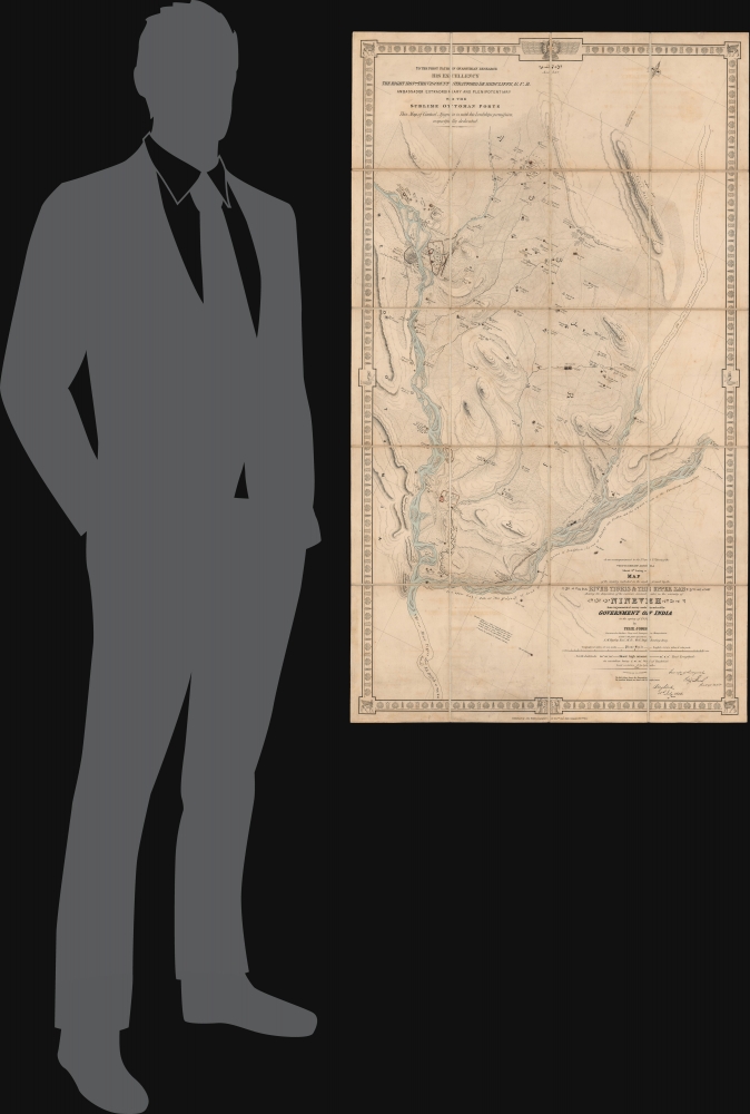
Digital Image: 1855 Jones Archeological Map of Nineveh, Numrud, and Mosul, Iraq
NinevehTigrisZab-jones-1855_d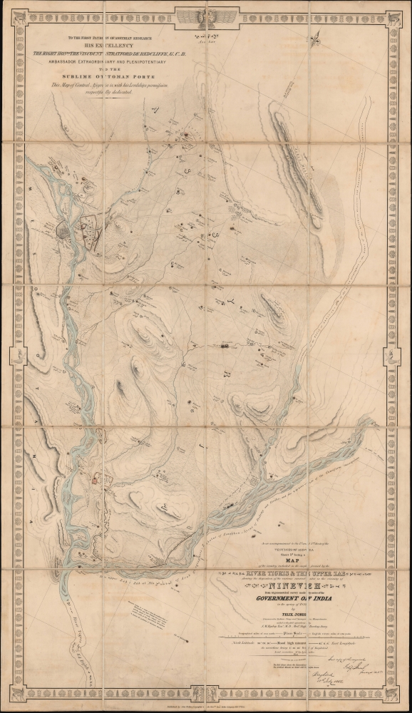

FOR THE ORIGINAL ANTIQUE MAP, WITH HISTORICAL ANALYSIS, CLICK HERE.
Digital Map Information
Geographicus maintains an archive of high-resolution rare map scans. We scan our maps at 300 DPI or higher, with newer images being 600 DPI, (either TIFF or JPEG, depending on when the scan was done) which is most cases in suitable for enlargement and printing.
Delivery
Once you purchase our digital scan service, you will receive a download link via email - usually within seconds. Digital orders are delivered as ZIP files, an industry standard file compression protocol that any computer should be able to unpack. Some of our files are very large, and can take some time to download. Most files are saved into your computer's 'Downloads' folder. All delivery is electronic. No physical product is shipped.
Credit and Scope of Use
You can use your digial image any way you want! Our digital images are unrestricted by copyright and can be used, modified, and published freely. The textual description that accompanies the original antique map is not included in the sale of digital images and remains protected by copyright. That said, we put significant care and effort into scanning and editing these maps, and we’d appreciate a credit when possible. Should you wish to credit us, please use the following credit line:
Courtesy of Geographicus Rare Antique Maps (http://www.geographicus.com).
How Large Can I Print?
In general, at 300 DPI, you should at least be able to double the size of the actual image, more so with our 600 DPI images. So, if the original was 10 x 12 inches, you can print at 20 x 24 inches, without quality loss. If your display requirements can accommodate some loss in image quality, you can make it even larger. That being said, no quality of scan will allow you to blow up at 10 x 12 inch map to wall size without significant quality loss. For more information, it is best consult a printer or reprographics specialist.
Refunds
If the high resolution image you ordered is unavailable, we will fully refund your purchase. Otherwise, digital images scans are a service, not a tangible product, and cannot be returned or refunded once the download link is used.
James Felix Jones (September 5, 1813 - September 3, 1878) was British officer of the East India Company and the Indian Navy. He served as surveyor, and amateur archeologist active in the Middle East in the mid-19th century. He was born in Shoreditch, London, England. He joined the Bombay Marine at 14, where an aptitude at mathematics led him to be taught surveying. He became involved in various British survey projects throughout the Middle East. As a midshipman on the RIMS Palinurus, he completed a series of surveys of the Red Sea littoral. By the 1820s, he was reassigned to the Persian Gulf, where he worked on the first British survey of those waters. In 1839, he surveyed Kuwait harbor. In addition to his military surveys, he accompanied Henry Creswicke Rawlinson on an overland journey from Baghdad to Hamadān, along the way producing a series of seminal archeological surveys of the ruins of antiquity. These included including the course of the ancient Nahrwan Canal (1848), the course of the Tigris and what he believed to be the site of Opis (1850), the Assyrian heartland (1852), Nimrud and Nineveh (1852), and the Baghdad area (1853). With years of Middle East experience behind him, Jones was assigned the position of Political Agent in the Persian Gulf. It has been argued that, in this capacity, he played a role in the British invasion of Persia (1856 - 1857). He retired from active service in 1862, suffering ill health and returning to London. He settled in Upper Norwood, Surrey, where he nonetheless continued to produce geographical work for the India Office. In 1875, he completed a beautifully drawn map of western Asia, including the valleys of the Tigris and Euphrates, which survives in manuscript but remains unpublished. Jones' 1878 Geographical Magazine obituary called him 'one of the greatest ornaments of the old Indian Navy'. More by this mapmaker...
John Walker (1787 - April 19, 1873) was a British map seller, engraver, lithographer, hydrographer, geographer, draughtsman, and publisher active in London during the 19th century. Walker published both nautical charts and geographical maps. His nautical work is particularly distinguished as he was an official hydrographer for the British East India Company, a position, incidentally, also held by his father of the same name. Walker's maps, mostly published after 1827, were primarily produced with his brothers Charles Walker and Alexander Walker under the imprint J. and C. Walker. Among their joint projects are more than 200 maps for the influential Society for the Diffusion of Useful Knowledge Atlas (SDUK). In addition they published numerous charts for James Horsburgh and the British Admiralty Hydrographic Office, including Belcher's important map of Hong Kong and Carless' exploratory map of Karachi. The J. and C. Walker firm continued to publish after both Walkers died in the 1870s. Learn More...
Copyright © 2025 Geographicus Rare Antique Maps | Geographicus Rare Antique Maps
This copy is copyright protected.
Copyright © 2025 Geographicus Rare Antique Maps