This copy is copyright protected.
Copyright © 2025 Geographicus Rare Antique Maps
Digital Image: 1852 Coello / Morata Case Map of the Philippines
Philipines1-morata-1852_d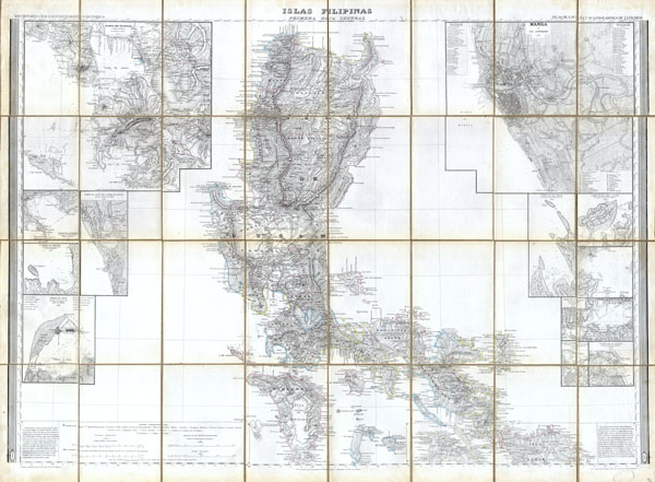

FOR THE ORIGINAL ANTIQUE MAP, WITH HISTORICAL ANALYSIS, CLICK HERE.
Digital Map Information
Geographicus maintains an archive of high-resolution rare map scans. We scan our maps at 300 DPI or higher, with newer images being 600 DPI, (either TIFF or JPEG, depending on when the scan was done) which is most cases in suitable for enlargement and printing.
Delivery
Once you purchase our digital scan service, you will receive a download link via email - usually within seconds. Digital orders are delivered as ZIP files, an industry standard file compression protocol that any computer should be able to unpack. Some of our files are very large, and can take some time to download. Most files are saved into your computer's 'Downloads' folder. All delivery is electronic. No physical product is shipped.
Credit and Scope of Use
You can use your digial image any way you want! Our digital images are unrestricted by copyright and can be used, modified, and published freely. The textual description that accompanies the original antique map is not included in the sale of digital images and remains protected by copyright. That said, we put significant care and effort into scanning and editing these maps, and we’d appreciate a credit when possible. Should you wish to credit us, please use the following credit line:
Courtesy of Geographicus Rare Antique Maps (http://www.geographicus.com).
How Large Can I Print?
In general, at 300 DPI, you should at least be able to double the size of the actual image, more so with our 600 DPI images. So, if the original was 10 x 12 inches, you can print at 20 x 24 inches, without quality loss. If your display requirements can accommodate some loss in image quality, you can make it even larger. That being said, no quality of scan will allow you to blow up at 10 x 12 inch map to wall size without significant quality loss. For more information, it is best consult a printer or reprographics specialist.
Refunds
If the high resolution image you ordered is unavailable, we will fully refund your purchase. Otherwise, digital images scans are a service, not a tangible product, and cannot be returned or refunded once the download link is used.
Francisco Coello de Portugal y Quesada (1822 - September 30, 1898) was a Spanish cartographer, explorer, and military engineer active in the mid-19th century. Coello was born in Jaen, Spain and joined the military in 1833, enrolling at the Special Army Corps of Engineers Academy of Guadalajara. Upon graduating with honors he joined Corps of Military Engineers where after serving in the First Carlist War, and later in Algeria, he attained the rank of Colonel. Coello later founded the Geographical Society of Madrid and served many years as its president. He was also a corresponding member of the American Geographical Society and a full member of the Real Sociedad Geográfica de España. Coello's greatest work, his monumental Atlas de España y sus posesiones de Ultramar, was truncated by his death in 1898 and consequently never completed. Nevertheless, the work is of historical significance as the first scientifically produced maps of Spain, Cuba, and Porto Rico. More by this mapmaker...
Copyright © 2025 Geographicus Rare Antique Maps | Geographicus Rare Antique Maps
This copy is copyright protected.
Copyright © 2025 Geographicus Rare Antique Maps