This copy is copyright protected.
Copyright © 2025 Geographicus Rare Antique Maps
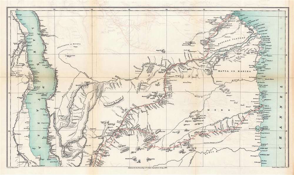
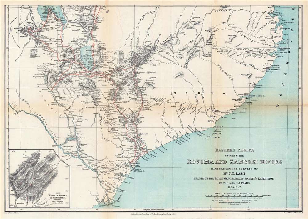
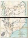
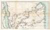
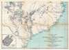
Digital Image: 1890 Shawe Map of the Rovuma and Zambesi Rivers, Southeast Africa
RovumaZambesiRivers-shawe-1890_d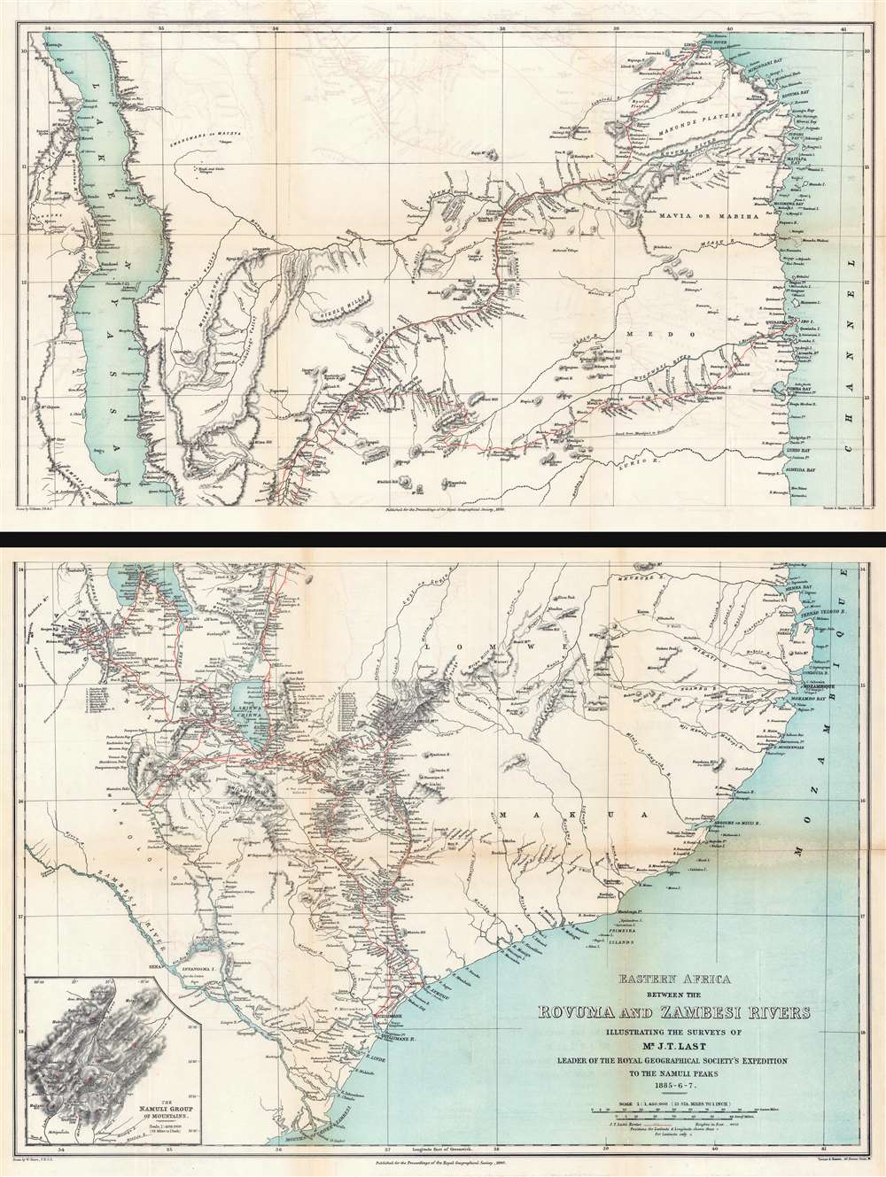

FOR THE ORIGINAL ANTIQUE MAP, WITH HISTORICAL ANALYSIS, CLICK HERE.
Digital Map Information
Geographicus maintains an archive of high-resolution rare map scans. We scan our maps at 300 DPI or higher, with newer images being 600 DPI, (either TIFF or JPEG, depending on when the scan was done) which is most cases in suitable for enlargement and printing.
Delivery
Once you purchase our digital scan service, you will receive a download link via email - usually within seconds. Digital orders are delivered as ZIP files, an industry standard file compression protocol that any computer should be able to unpack. Some of our files are very large, and can take some time to download. Most files are saved into your computer's 'Downloads' folder. All delivery is electronic. No physical product is shipped.
Credit and Scope of Use
You can use your digial image any way you want! Our digital images are unrestricted by copyright and can be used, modified, and published freely. The textual description that accompanies the original antique map is not included in the sale of digital images and remains protected by copyright. That said, we put significant care and effort into scanning and editing these maps, and we’d appreciate a credit when possible. Should you wish to credit us, please use the following credit line:
Courtesy of Geographicus Rare Antique Maps (http://www.geographicus.com).
How Large Can I Print?
In general, at 300 DPI, you should at least be able to double the size of the actual image, more so with our 600 DPI images. So, if the original was 10 x 12 inches, you can print at 20 x 24 inches, without quality loss. If your display requirements can accommodate some loss in image quality, you can make it even larger. That being said, no quality of scan will allow you to blow up at 10 x 12 inch map to wall size without significant quality loss. For more information, it is best consult a printer or reprographics specialist.
Refunds
If the high resolution image you ordered is unavailable, we will fully refund your purchase. Otherwise, digital images scans are a service, not a tangible product, and cannot be returned or refunded once the download link is used.
Royal Geographical Society (fl. 1830 - present) is a British Society established in 1830 to promote geographical science and exploration. Originally titled the "Geographical Society of London", the RGS received its royal charter from Queen Victoria in 1859 shortly after absorbing several similar but more regional societies including the African Association, the Raleigh Club and the Palestine Association. The RGS sponsored many of the most important and exciting voyages of exploration ever undertaken, including the exploration of Charles Darwin, David Livingstone, Robert Falcon Scott, Richard F. Burton, John Speke, George Hayward, H. M Stanley, Ernest Shackleton and Sir Edmond Hillary. Today, the RGS remains a leading global sponsor of geographical and scientific studies. The Society is based in Lowther Lodge, South Kensington, London. More by this mapmaker...
Joseph Thomas Last (December 25, 1848 - December 13, 1933) was an English missionary, naturalist, and explorer. Born in Tuddenham, Suffolk, Last was ordained at the Church Missionary College in 1872. He set out for East Africa for the first time in October 1874 and established a mission at Kisulutini, East Equatorial Africa. He returned to Britain in 1876 for unknown reasons before being sent back in November 1877. He was then appointed to the Usagara Mission in Mpwapwa, and in 1880 went on to found a new mission in the Nguru Mountains at Mamboya. He returned to Britain in December 1884 after living in Africa for seven years. Shortly thereafter, in 1885, he was engaged by the Royal Geographical Society to explore the Namuli Mountains. That expedition lasted until April 1887. In 1897, he was appointed Commissioner of Slavery for the Island of Zanzibar. He married his first wife, Annie Jackson, in September 1880. Jackson joined him in Africa and became the first European woman to reside at the Nyanza Mission. Jackson died in 1883. At some point Last remarried, although it is unknown when. Last died in 1933 and is remembered as 'a man of robust and virile personality' who possessed 'an unrivalled knowledge of Swahili'. He is also remembered for his contributions to conchology, having collected countless specimens in his travels, some of which have never been recollected. Learn More...
Copyright © 2025 Geographicus Rare Antique Maps | Geographicus Rare Antique Maps
This copy is copyright protected.
Copyright © 2025 Geographicus Rare Antique Maps