This copy is copyright protected.
Copyright © 2025 Geographicus Rare Antique Maps
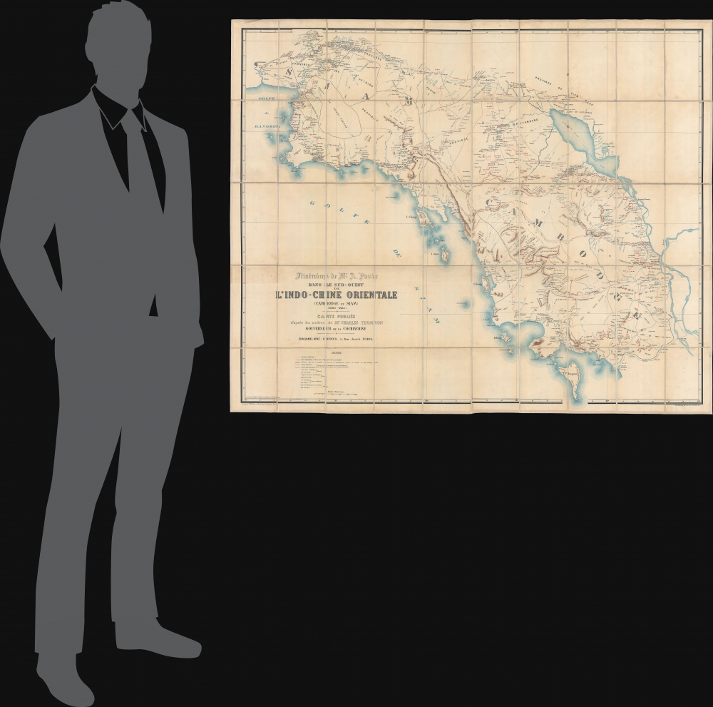
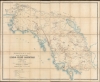
Digital Image: 1885 Pavie Map of Southern Thailand and Cambodia - First Mission Pavie
SiamCambodge-pavie-1885_d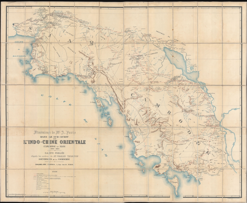

FOR THE ORIGINAL ANTIQUE MAP, WITH HISTORICAL ANALYSIS, CLICK HERE.
Digital Map Information
Geographicus maintains an archive of high-resolution rare map scans. We scan our maps at 300 DPI or higher, with newer images being 600 DPI, (either TIFF or JPEG, depending on when the scan was done) which is most cases in suitable for enlargement and printing.
Delivery
Once you purchase our digital scan service, you will receive a download link via email - usually within seconds. Digital orders are delivered as ZIP files, an industry standard file compression protocol that any computer should be able to unpack. Some of our files are very large, and can take some time to download. Most files are saved into your computer's 'Downloads' folder. All delivery is electronic. No physical product is shipped.
Credit and Scope of Use
You can use your digial image any way you want! Our digital images are unrestricted by copyright and can be used, modified, and published freely. The textual description that accompanies the original antique map is not included in the sale of digital images and remains protected by copyright. That said, we put significant care and effort into scanning and editing these maps, and we’d appreciate a credit when possible. Should you wish to credit us, please use the following credit line:
Courtesy of Geographicus Rare Antique Maps (http://www.geographicus.com).
How Large Can I Print?
In general, at 300 DPI, you should at least be able to double the size of the actual image, more so with our 600 DPI images. So, if the original was 10 x 12 inches, you can print at 20 x 24 inches, without quality loss. If your display requirements can accommodate some loss in image quality, you can make it even larger. That being said, no quality of scan will allow you to blow up at 10 x 12 inch map to wall size without significant quality loss. For more information, it is best consult a printer or reprographics specialist.
Refunds
If the high resolution image you ordered is unavailable, we will fully refund your purchase. Otherwise, digital images scans are a service, not a tangible product, and cannot be returned or refunded once the download link is used.
Auguste Jean-Marie Pavie (May 31, 1847 - June 7, 1925) was a French civil servant, explorer, and diplomate active in Southeast Asia in the late 19th and early 20th century. Pavie was born in Dinan, Brittany, the son of a cabinetmaker. As a young man he had a thirst for travel and adventure, joining the army in 1864, at age 17. By 1869 he was in Cochinchina (Vietnam) with the Troupes de Marine. He returned briefly to France to fight the Franco-Prussian War (1870 - 1871) but was back in Indochina by late 1871. He was posted to the telegraph station at Kampot, Cambodia, where he remained until about 1879. During this time, he 'went native', wearing local clothing and mastering Cambodian. In 1879, he caught the attention of Charles Le Myre de Vilers (1833 - 1918), governor of Cochinchina. Le Myre de Vilers assigned him to the first of what would become known collectively as the 'Missions Pavie' (1879 - 1895), a series of groundbreaking expeditions spanning some 16 years into the little-known interior of Southeast Asia:
Jean Baptiste Marius Augustin Challamel (March 18, 1818 - October 20, 1894) was a French historian, editor, and publisher active in Paris in the mid to late 19th century. Challamel is best known as a historian. Even so, although prolific, his personal work more often falls into pop-history and has little originality or merit. More significantly, Challamel also founded Challamel et Cie., a publishing house at 5 Rue Jacob. From this location, Challamel published extensively for French colonial interests in Africa, Asia, Indochina, and Polynesia. His work includes some of the most significant works documenting late 19th century French scientific discoveries, navigation, cartography, and scholarship. He held the contract for official French colonial office printings, including for the Bureau Topographique and the Service Geographique. Although Challamel died in 1894, his firm continued to operate until the 1920s. His heirs, operating under the same name, moved tore 17 Rue Jacob and renamed their firm Librairie Maritime et Coloniale, Augustin Challamel, Editeur. Learn More...
Eugène Dufrenoy (January 21, 1834 - 190x), aka Dufrenois, was a French printer, lithographer, and engraver active in Paris during the second half of the 19th and the early 20th centuries. Dufrénoy born in Bourg-la-Reine, in what is today the southern suburbs of Paris. He was based, for at least part of his career, at 34 Rue du Four, Paris. In 1881 Dufrénoy acquired a large space at 49 Rue du Montparnasse. This space still operates as a printshop with Dufrénoy's old presses as IDEM Paris. ˜ Learn More...
Copyright © 2025 Geographicus Rare Antique Maps | Geographicus Rare Antique Maps
This copy is copyright protected.
Copyright © 2025 Geographicus Rare Antique Maps