This copy is copyright protected.
Copyright © 2025 Geographicus Rare Antique Maps
Digital Image: 1617 Le Clerc Map of Dombes, France (Bugey Wine Region)
SouvraineteDombes-leclerc-1617_d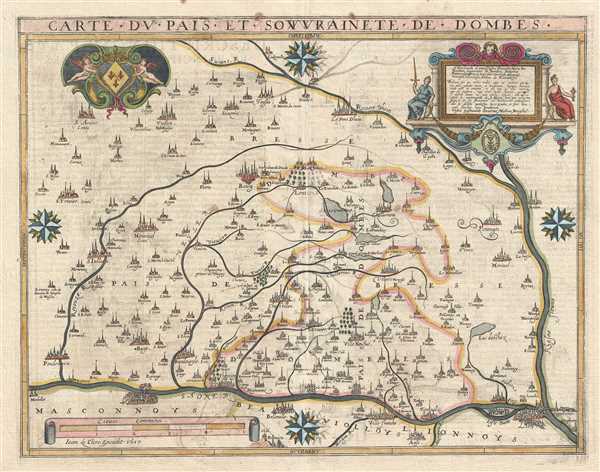

FOR THE ORIGINAL ANTIQUE MAP, WITH HISTORICAL ANALYSIS, CLICK HERE.
Digital Map Information
Geographicus maintains an archive of high-resolution rare map scans. We scan our maps at 300 DPI or higher, with newer images being 600 DPI, (either TIFF or JPEG, depending on when the scan was done) which is most cases in suitable for enlargement and printing.
Delivery
Once you purchase our digital scan service, you will receive a download link via email - usually within seconds. Digital orders are delivered as ZIP files, an industry standard file compression protocol that any computer should be able to unpack. Some of our files are very large, and can take some time to download. Most files are saved into your computer's 'Downloads' folder. All delivery is electronic. No physical product is shipped.
Credit and Scope of Use
You can use your digial image any way you want! Our digital images are unrestricted by copyright and can be used, modified, and published freely. The textual description that accompanies the original antique map is not included in the sale of digital images and remains protected by copyright. That said, we put significant care and effort into scanning and editing these maps, and we’d appreciate a credit when possible. Should you wish to credit us, please use the following credit line:
Courtesy of Geographicus Rare Antique Maps (http://www.geographicus.com).
How Large Can I Print?
In general, at 300 DPI, you should at least be able to double the size of the actual image, more so with our 600 DPI images. So, if the original was 10 x 12 inches, you can print at 20 x 24 inches, without quality loss. If your display requirements can accommodate some loss in image quality, you can make it even larger. That being said, no quality of scan will allow you to blow up at 10 x 12 inch map to wall size without significant quality loss. For more information, it is best consult a printer or reprographics specialist.
Refunds
If the high resolution image you ordered is unavailable, we will fully refund your purchase. Otherwise, digital images scans are a service, not a tangible product, and cannot be returned or refunded once the download link is used.
Jean Le Clerc (1560 - 1621) was a French bookseller, engraver, and publisher active in Paris during the late 16th and early 17th centuries. Le Clerc, along with Maruice Bouguereau pubslihed the 1594 Theatre Geographique du Royaume de France, was subsequently republished in several editions. Le Clerc also commissioned the Dutch cartographer Jodocus Hondius to compile a world map and several continent maps to accompany later editions of the atlas. The Theatre Geographique du Royaume de France was issued in 1620, 1621, 1622, 1626, and 1631. Most editions were published posthumously Jean Boisseau, who acquired the map plates from Le Clerc's widow. Most likely there was also an unrecorded 1633 issue. Le Clerc should not be confused with another publisher and biblical scholar of the same name active in the late 17th and early 18th centuries. More by this mapmaker...
Copyright © 2025 Geographicus Rare Antique Maps | Geographicus Rare Antique Maps
This copy is copyright protected.
Copyright © 2025 Geographicus Rare Antique Maps