Digital Image: 1686 Dapper View of Tripoli, Libya
Tripoli-dapper-1686_d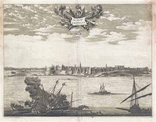

Title
De Stadt Tripolis. La Ville de Tripoli.
1686 (undated) 10.75 x 14 in (27.305 x 35.56 cm)
1686 (undated) 10.75 x 14 in (27.305 x 35.56 cm)
Description
FOR THE ORIGINAL ANTIQUE MAP, WITH HISTORICAL ANALYSIS, CLICK HERE.
Digital Map Information
Geographicus maintains an archive of high-resolution rare map scans. We scan our maps at 300 DPI or higher, with newer images being 600 DPI, (either TIFF or JPEG, depending on when the scan was done) which is most cases in suitable for enlargement and printing.
Delivery
Once you purchase our digital scan service, you will receive a download link via email - usually within seconds. Digital orders are delivered as ZIP files, an industry standard file compression protocol that any computer should be able to unpack. Some of our files are very large, and can take some time to download. Most files are saved into your computer's 'Downloads' folder. All delivery is electronic. No physical product is shipped.
Credit and Scope of Use
You can use your digial image any way you want! Our digital images are unrestricted by copyright and can be used, modified, and published freely. The textual description that accompanies the original antique map is not included in the sale of digital images and remains protected by copyright. That said, we put significant care and effort into scanning and editing these maps, and we’d appreciate a credit when possible. Should you wish to credit us, please use the following credit line:
Courtesy of Geographicus Rare Antique Maps (https://www.geographicus.com).
How Large Can I Print?
In general, at 300 DPI, you should at least be able to double the size of the actual image, more so with our 600 DPI images. So, if the original was 10 x 12 inches, you can print at 20 x 24 inches, without quality loss. If your display requirements can accommodate some loss in image quality, you can make it even larger. That being said, no quality of scan will allow you to blow up at 10 x 12 inch map to wall size without significant quality loss. For more information, it is best consult a printer or reprographics specialist.
Refunds
If the high resolution image you ordered is unavailable, we will fully refund your purchase. Otherwise, digital images scans are a service, not a tangible product, and cannot be returned or refunded once the download link is used.
Cartographer
Olfert Dapper (1636 - December 29, 1689) was a Dutch geographer, polyglot, and historian. Born in Amsterdam, he attended the University of Utrecht, where he was registered as a student in 1658. Two years later he began signing doctor medicinæ, but there in no evidence that he ever received any medical training or education. Dapper published a five-volume book about the history of Amsterdam entitled, Historische Beschrijving der Stadt Amsterdam and in 1665 published a Dutch translation from the Greek of the Histories of Herodotus. His best-known work, Naukeurige Beschrijvingen der Afrikaensche gewesten (Description of Africa), was published in 1668 and subsequently published in English by John Ogilby in 1670 and in French in 1686. Although Dapper never traveled to Africa, he took advantage of numerous reports from adventurers in order to compile this authoritative work over the course of three years. More by this mapmaker...