Digital Image: 1840 Arthus-Bertrand / Levshin Map of Central Asia; Russian Empire
Turkestan-arthusbertrand-1840_d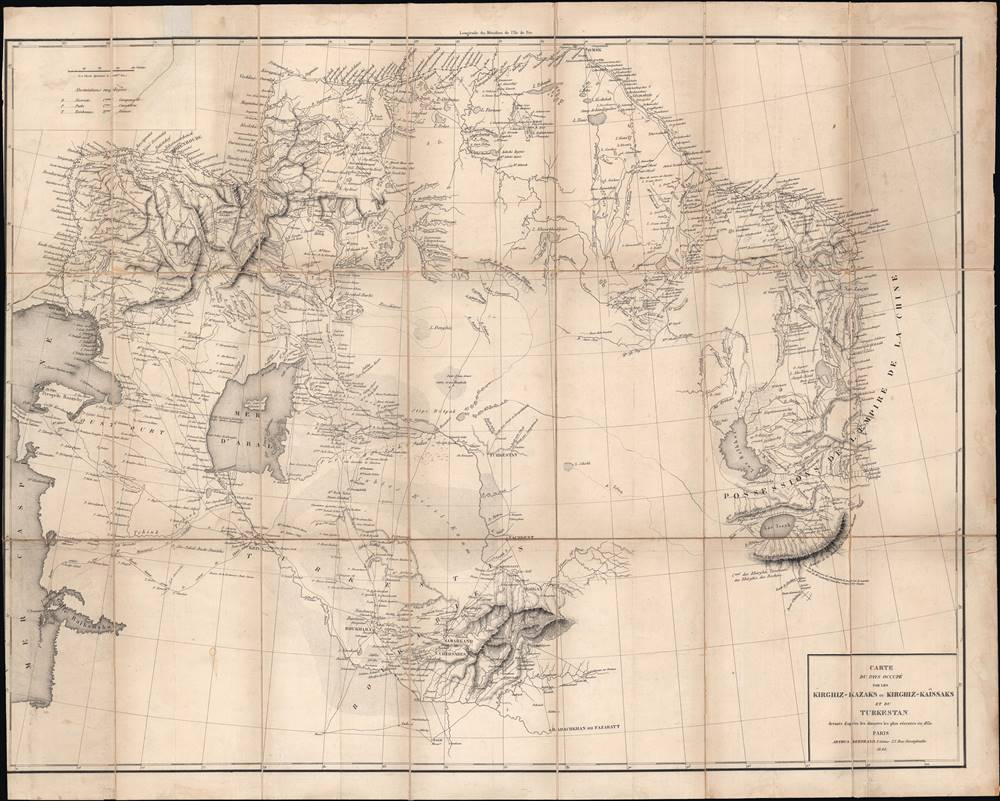

Title
Carte du pays occupé par les Kirghiz - Kazaks ou Kirghiz - Kaissaks et du Turkestan.
1840 (dated) 20.5 x 26.5 in (52.07 x 67.31 cm) 1 : 4500000
1840 (dated) 20.5 x 26.5 in (52.07 x 67.31 cm) 1 : 4500000
Description
FOR THE ORIGINAL ANTIQUE MAP, WITH HISTORICAL ANALYSIS, CLICK HERE.
Digital Map Information
Geographicus maintains an archive of high-resolution rare map scans. We scan our maps at 300 DPI or higher, with newer images being 600 DPI, (either TIFF or JPEG, depending on when the scan was done) which is most cases in suitable for enlargement and printing.
Delivery
Once you purchase our digital scan service, you will receive a download link via email - usually within seconds. Digital orders are delivered as ZIP files, an industry standard file compression protocol that any computer should be able to unpack. Some of our files are very large, and can take some time to download. Most files are saved into your computer's 'Downloads' folder. All delivery is electronic. No physical product is shipped.
Credit and Scope of Use
You can use your digial image any way you want! Our digital images are unrestricted by copyright and can be used, modified, and published freely. The textual description that accompanies the original antique map is not included in the sale of digital images and remains protected by copyright. That said, we put significant care and effort into scanning and editing these maps, and we’d appreciate a credit when possible. Should you wish to credit us, please use the following credit line:
Courtesy of Geographicus Rare Antique Maps (http://www.geographicus.com).
How Large Can I Print?
In general, at 300 DPI, you should at least be able to double the size of the actual image, more so with our 600 DPI images. So, if the original was 10 x 12 inches, you can print at 20 x 24 inches, without quality loss. If your display requirements can accommodate some loss in image quality, you can make it even larger. That being said, no quality of scan will allow you to blow up at 10 x 12 inch map to wall size without significant quality loss. For more information, it is best consult a printer or reprographics specialist.
Refunds
If the high resolution image you ordered is unavailable, we will fully refund your purchase. Otherwise, digital images scans are a service, not a tangible product, and cannot be returned or refunded once the download link is used.
Cartographer S
Claude Arthus-Bertrand (1769-1840) was a French army officer during the French Revolution. In the Napoleonic era, he founded a firm (Arthus-Bertrand, 1803 – present) that specializes in producing military medals, decorations, and insignia, often for the French government. Arthus-Bertrand was also an enthusiast of scientific expeditions and founded a publisher to promote them, which became the official editor of the Ministère de la Marine in the 1830s, where it oversaw the publication of the accounts of the 1836 – 1837 Bonite expedition that circumnavigated the globe. More by this mapmaker...
Aleksei Iraklievich Levshin (Алексей Ираклиевич Левшин; 1798 - 1879) was a Russian statesman, historian, writer, and ethnographer. Born to a wealthy family, he studied at the Kharkiv Imperial University and the Collegium of Foreign Affairs, after which he was posted to the Orenburg Border Commission and undertook an intensive study of nearby Central Asian populations in Russia and what is now Kazakhstan, making him a pioneer in the study of Central Asia in Europe. He later took on several government duties and advocated for the emancipation of the serfs. He was also a founding member of the Imperial Russian Geographical Society. Learn More...