This copy is copyright protected.
Copyright © 2025 Geographicus Rare Antique Maps
Digital Image: 1901 Chicago and Eastern Illinois Railroad Map of the Central United States
ChicagoEasternIllinois-poolebros-1901_d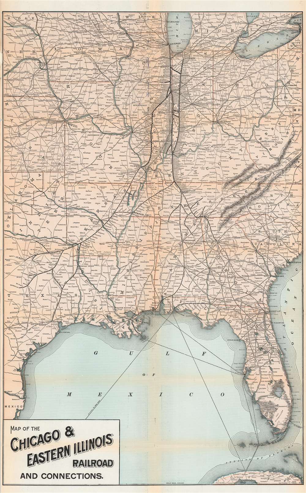

FOR THE ORIGINAL ANTIQUE MAP, WITH HISTORICAL ANALYSIS, CLICK HERE.
Digital Map Information
Geographicus maintains an archive of high-resolution rare map scans. We scan our maps at 300 DPI or higher, with newer images being 600 DPI, (either TIFF or JPEG, depending on when the scan was done) which is most cases in suitable for enlargement and printing.
Delivery
Once you purchase our digital scan service, you will receive a download link via email - usually within seconds. Digital orders are delivered as ZIP files, an industry standard file compression protocol that any computer should be able to unpack. Some of our files are very large, and can take some time to download. Most files are saved into your computer's 'Downloads' folder. All delivery is electronic. No physical product is shipped.
Credit and Scope of Use
You can use your digial image any way you want! Our digital images are unrestricted by copyright and can be used, modified, and published freely. The textual description that accompanies the original antique map is not included in the sale of digital images and remains protected by copyright. That said, we put significant care and effort into scanning and editing these maps, and we’d appreciate a credit when possible. Should you wish to credit us, please use the following credit line:
Courtesy of Geographicus Rare Antique Maps (http://www.geographicus.com).
How Large Can I Print?
In general, at 300 DPI, you should at least be able to double the size of the actual image, more so with our 600 DPI images. So, if the original was 10 x 12 inches, you can print at 20 x 24 inches, without quality loss. If your display requirements can accommodate some loss in image quality, you can make it even larger. That being said, no quality of scan will allow you to blow up at 10 x 12 inch map to wall size without significant quality loss. For more information, it is best consult a printer or reprographics specialist.
Refunds
If the high resolution image you ordered is unavailable, we will fully refund your purchase. Otherwise, digital images scans are a service, not a tangible product, and cannot be returned or refunded once the download link is used.
Poole Brothers (fl. c. 1880 - 1968) were a Chicago based firm active in the late 19th and early 20th century with an initial focus on promotional railroad maps. Poole Brothers was founded by George Amos Poole, one of the original four partners in the firm that would become Rand McNally, and his brother William H. Poole. Poole started his own firm, Poole Brothers, as a direct competitor to Rand McNally for the lucrative railroad business. Like many of its competitors, Poole Brothers maintained an office on Chicago's Printer's Row (downtown Loop district). Nevertheless, the two firms, along with Cram and Company, seem to have come to an accord, at least with regard to price-fixing, for which they were cited by the Federal Trade Commission in 1948. Their earliest known work is an 1880 map of Yellowstone National Park. Afterward they went on to produce a vast range of maps and other print products including tickets, cards, coupons, and restaurant menus. In time Poole Brothers merged with Newman-Randolph, which was then acquired by the American Can Company in the early 1960s. The American Can Company liquidated its printing concerns later in the same decade. More by this mapmaker...
Copyright © 2025 Geographicus Rare Antique Maps | Geographicus Rare Antique Maps
This copy is copyright protected.
Copyright © 2025 Geographicus Rare Antique Maps